
We’re having a classic wet, sloppy, snowy spring storm today. It started last night and is expected to continue through tomorrow. So far, we’ve gotten about 9 inches of very wet snow, with about the same amount expected through today.
This is called an “upslope storm” because winds circling around a low pressure in the Texas panhandle are pumping moisture through the Great Plains. The moisture flows nicely — until it hits the mountains.
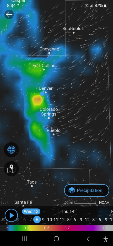
This image from my phone weather app shows the wind blowing briskly — right up until it hits — literally hits — the Front Range. You can’t tell from this image, because it is take at just one elevation, but the wind then rises. The moisture is too heavy to make the upward turn, and falls. Because it’s spring, this moisture is falling as very wet snow that shows up as all the pretty colors in the mountains west of the major cities. You can tell where the other side of the mountains are because the colors return to black, and there are no streaks showing wind. The result is nine inches of snow in the cities, and feet of snow in the mountains.

Leave a comment